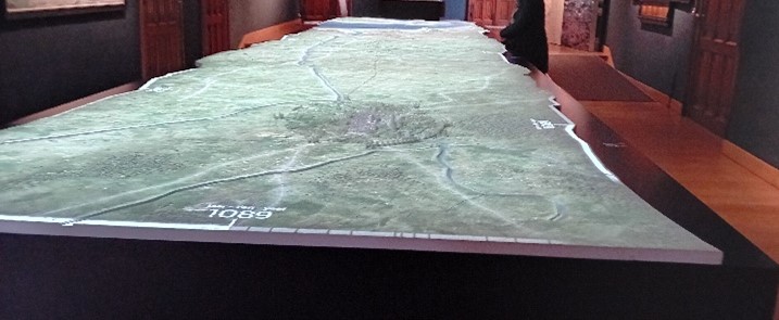
Hazel’s birthday this month gave us a good excuse to re-visit Bruges for a nice change of scenery, even if we did get snow! In addition to our normal long walks round the inner city (and some bars of course) the cold gave us reason to visit some galleries and displays, such as the amazing inter-active map of Bruges and its links to the sea at the Bruges City Hall (see photos) The map, with its accompanying light show and commentary, graphically depicts the changes in sea levels combined with sudden massive floods and steady silting of the vital Zwin channel that linked Bruges to the sea.
All this puts in context the rise of Bruges as a major (and for some time the major) North Sea port. In early medieval times the city was the capital of the broad region of Flanders, which ran east across today’s Belgian and French borders. It was strategically significant as it lay opposite Dover and other key English ports, and was also close to Normandy to the west. In fact, Judith, the young daughter of the then Frankish king, successively married King Alfred’s father and elder brother back in the 9th century! When they died in quick succession Judith escaped back to France and eloped with a man called Baldwin, who became the first Count of Flanders. Judith must have had quite a story to tell! In the 11th century, Baldwin’s descendant, Baldwin V, became not only the father-in-law of William the Conqueror but also a thorn in the side of Edward the Confessor and a contributor to events that led up to the Norman Conquest.

There will be more detail in my Book 2 now in preparation, the follow-up to Ice to Athelstan – The Emergence of England.
Just a reminder that I’d love to hear any other thoughts from those who have read Emergence and for you to ‘like’ this post – if you do!

